
Greaves Hall, Banks, 1986.

Crossen's Drainage Scheme under construction, 1958.
Up until the 1900s, gravity was all that was needed to drain the land to sea. However, as the marshy areas dried, they shrank down below sea level. Since the 1920s, pumping has been used to take water off the land and out to the sea. Today's network consists of smaller drainage ditches and watercourses.

Crossen's Drainage Scheme completed, 1961.
Crossen's Pumping Station is one of the main stations used to pump water from the Alt and Crossens catchments into the sea. Supported by another pumping station at Altmouth (built in 1972), there are an additional nine smaller stations and hundreds of miles of drainage channels and watercourses.
Aerial view of Banks, c1958.

Aerial view of Hundred End Railway Station and surrounding area, 1955.

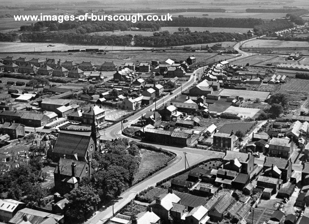
Aerial view of Hesketh Bank, 1971.

Aerial view of Rufford Road area, Crossens, 1960.

Aerial view of Rufford, 1970.
(Photo courtesy - Pauline Smith)

Aerial view of Moorgate / Aughton Street / Coronation Park area, Ormskirk, c1960s.
(Photo courtesy - Ernest Rosbottam Collection / Stuart & Lynne Gray)

Aerial view of St Helen's Road / Knowsley Road / Ruff Lane area, Ormskirk, c1960s.
(Photo courtesy - Ernest Rosbottam Collection / Stuart & Lynne Gray)

Aerial view of Ormskirk Town Centre, c1960.
(Photo courtesy - Ernest Rosbottam Collection / Stuart & Lynne Gray)

Aerial view of Moor Street / Moorgate area, Ormskirk, c1960s.
(Photo courtesy - Ernest Rosbottam Collection / Stuart & Lynne Gray)

Aerial view of Hants Lane, Green Lane, Burscough Street, Derby Street West area, Ormskirk, c1960s.
(Photo courtesy - Ernest Rosbottam Collection / Stuart & Lynne Gray)

Aerial view of County Road / Southport Road / Halsall Lane area, Ormskirk, c1960s.
(Photo courtesy - Ernest Rosbottam Collection / Stuart & Lynne Gray)

Aerial view of Ormskirk Railway Station / Greetby Hill area, Ormskirk, c1960s.
(Photo courtesy - Ernest Rosbottam Collection / Stuart & Lynne Gray)

Aerial view of Ormskirk Town Centre area, 1960s, showing Coronation Park, the old Park Road, Church Street, Aughton Street, Moor Street and Burscough Street.
(Photo courtesy - Ernest Rosbottam Collection / Stuart & Lynne Gray)

Crossen's Drainage Scheme under construction, 1960.

Aerial view of King George V College, Scarisbrick New Road and South FC's ground, Haig Avenue, Southport, 1971.

Aerial view of Preston New Road, Crossens, 1960.

The Pier and Floral Hall area, Southport Promenade, 1956.

Aerial view of the three way rail junction by Meols Cop Station (lower right), Southport, 1958.
(Southport, Preston, Manchester)

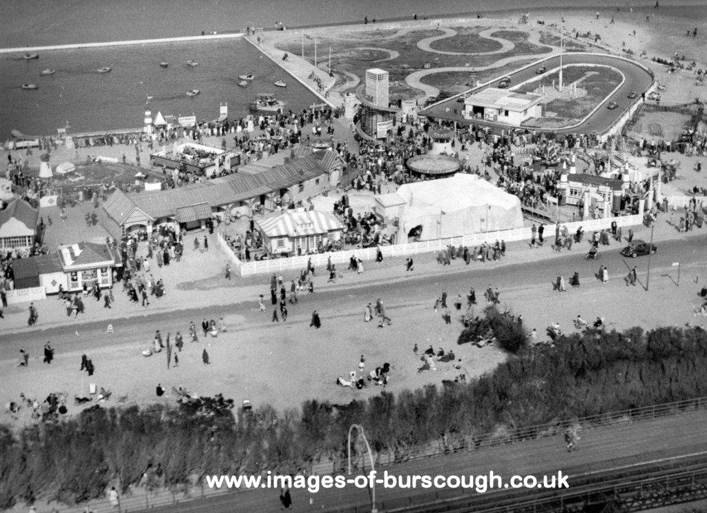
Aerial view of Pleasureland, Southport, 1958.
Aerial view of Peter Pan's Playground, Southport, 1960.